OpenSeaMap-dev:En:Documentation and Communication: Unterschied zwischen den Versionen
Markus (Diskussion | Beiträge) (→Public Relations: https) |
Markus (Diskussion | Beiträge) (Menü) |
||
| (3 dazwischenliegende Versionen desselben Benutzers werden nicht angezeigt) | |||
| Zeile 1: | Zeile 1: | ||
| + | {|border="0" cellpadding="6" cellspacing="0" width="100%" | ||
| + | !style="background:#E3E3E3;" | [[OpenSeaMap-dev:De:Documentation_and_Communication|Deutsch]] | ||
| + | !style="background:#E3E3E3;" | [[OpenSeaMap-dev:En:Documentation_and_Communication|English]] | ||
| + | !style="background:#E3E3E3; width:100%;" | | ||
| + | |} | ||
| + | |||
| + | |||
== Where to find help == | == Where to find help == | ||
=== Users === | === Users === | ||
| Zeile 18: | Zeile 25: | ||
=== Full screen map === | === Full screen map === | ||
| − | [[File:GEBCO-OpenSeaMap-Water-depts-Nordatlantic.jpg|thumb|fullscreen | + | [[File:GEBCO-OpenSeaMap-Water-depts-Nordatlantic.jpg|thumb|fullscreen chart]] |
[https://map.OpenSeaMap.org map.OpenSeaMap.org] is the skipper's working platform on the web. | [https://map.OpenSeaMap.org map.OpenSeaMap.org] is the skipper's working platform on the web. | ||
<br>Here the skipper can find the nautical chart, the land map, an aerial view, the weather map with weather forecast, a sea profile and an altitude profile, a harbor handbook, sport layers for divers and canoeists, AIS layers, gauge layers, Wikipedia layers, a trip planner, a tool to email a map view with markers and text, and of course an overview of uploaded depth tracks. | <br>Here the skipper can find the nautical chart, the land map, an aerial view, the weather map with weather forecast, a sea profile and an altitude profile, a harbor handbook, sport layers for divers and canoeists, AIS layers, gauge layers, Wikipedia layers, a trip planner, a tool to email a map view with markers and text, and of course an overview of uploaded depth tracks. | ||
| Zeile 56: | Zeile 63: | ||
=== Images === | === Images === | ||
| − | [[File:OpenSeaMap | + | [[File:OpenSeaMap-Logger mit Groessenvergleich2.jpg|thumb|image example]] |
{| | {| | ||
| valign="top" | [[File:Commons-logo.svg|50px|left]] | | valign="top" | [[File:Commons-logo.svg|50px|left]] | ||
| Zeile 76: | Zeile 83: | ||
| valign="top" | [[File:OpenSeaMap-Logo.svg|50px|left]] | | valign="top" | [[File:OpenSeaMap-Logo.svg|50px|left]] | ||
| Specific help pages and HowTo's aimed at users, explaining the full screen map and individual OpenSeaMap applications, <br> are stored in the OpenSeaMap Wiki. | | Specific help pages and HowTo's aimed at users, explaining the full screen map and individual OpenSeaMap applications, <br> are stored in the OpenSeaMap Wiki. | ||
| − | The wiki here serves only as a "text repository". The individual pages are linked directly on the website, full screen map, in applications or in manuals. <br> Examples: [[h:En: | + | The wiki here serves only as a "text repository". The individual pages are linked directly on the website, full screen map, in applications or in manuals. <br> Examples: [[h:En:Trip_Planner|Trip planer]], [[h:En:OpenSeaMap_in_Website|Integrate OpenSeaMap into Website]], [[h:En:Marker_in_URL|Integrate Marker into URL]] |
|} | |} | ||
| Zeile 98: | Zeile 105: | ||
=== Forum === | === Forum === | ||
| − | Users post their questions in the [ | + | Users post their questions in the [https://forum.openseamap.org/index.php forum]. There is a subforum for each topic, in German and in English. The goal is that users exchange their experiences and learn with and from each other. One finds there also information to users and answers from developers. |
<!-- | <!-- | ||
| Zeile 110: | Zeile 117: | ||
[[Category:Promotion]] | [[Category:Promotion]] | ||
| − | |||
| − | |||
Aktuelle Version vom 28. Februar 2021, 18:09 Uhr
| Deutsch | English |
|---|
Inhaltsverzeichnis
Where to find help
Users
- for devices: read the included documentation (e.g. for the depth logger)
or the detailed wiki documentation linked in the doc. - for mapping: read the OSM wiki
there you can find detailed explanations for each object
use the "search" in the wiki (sometimes the English term helps)
or read the OSM forum - for questions about OpenSeaMap: read the OpenSeaMap-Forum
use the "search" in the forum (sometimes the english term helps) - if you get stuck: ask a search engine
additionally enter "OpenSeaMap" or "OSM" (OpenStreetMap) as search term
Organizations
Authorities, organizations and companies please contact directly the contact address given on the website.
Press
Please direct press inquiries to the contact address listed on the website.
Public Relations
Website
OpenSeaMap.org is the showcase to the world.
We show the latest news there, an example of how to embed the map in the website, and link to lots of related information.
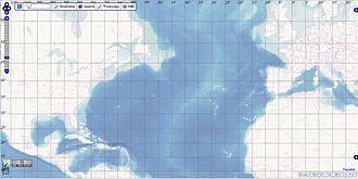
Full screen map
map.OpenSeaMap.org is the skipper's working platform on the web.
Here the skipper can find the nautical chart, the land map, an aerial view, the weather map with weather forecast, a sea profile and an altitude profile, a harbor handbook, sport layers for divers and canoeists, AIS layers, gauge layers, Wikipedia layers, a trip planner, a tool to email a map view with markers and text, and of course an overview of uploaded depth tracks.
facebook.com/OpenSeaMap is a fresh new page with news and tips.
Press
OpenSeaMap published in:
- Hydro International
- Hydrographic News
- Yacht
- Bowline
- and many more...
Fairs and congresses
OpenSeaMap can often be found at:
- "boot" Düsseldorf
- INTERGEO
- FOSSGIS
- CCC
And from time to time at:
- Hydrographentag
- State of the Map
- WikiCon
Documentation
We distribute information "top-down" to the appropriate platforms:
Wikipedia
Everything that is of interest to the general public is documented in Wikipedia. This is the only way our knowledge reaches the whole world. A lot of things just need a little encyclopedic writing, then they are excellent for Wikipedia. We are the experts on sea charts and nautical knowledge. Let's share it with the rest of the world!
Examples: OpenSeaMap, GPS, AIS, ENC, etc. Code for links here on the wiki: [[wikipedia:en:..|..]].
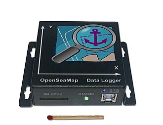
Images
| Commons is the largest free image database in the world. All images stored there can be linked directly in any media wiki. All images from Wikipedia come from Commons. So let's upload all images directly to Commons, then they will be available worldwide. "CC0" is recommended as the freest possible license.
Examples: our images |
OSM-Wiki
| Anything that might be of interest to OSMers is documented in the OSM-Wiki. OpenSeaMap is part of OpenStreetMap. Examples: our tagging scheme, keys and values, quality tools, general OSM keys for objects on land. |
Help pages
| Specific help pages and HowTo's aimed at users, explaining the full screen map and individual OpenSeaMap applications, are stored in the OpenSeaMap Wiki. The wiki here serves only as a "text repository". The individual pages are linked directly on the website, full screen map, in applications or in manuals. |
Developer doc
| Everything concerning developers, their code, planning, research, development, interfaces, applications and background information is stored in the OpenSeaMap-dev wiki. Results from discussions on the dev-ML are also recorded on the OpenSeaMap-dev wiki. |
Code
| OpenSeaMap code is stored in GitHub.
Please report bug reports, enhancement requests and ideas as "issue" in GitHub, please in the appropriate repository each time.
|
Communication
Forum
Users post their questions in the forum. There is a subforum for each topic, in German and in English. The goal is that users exchange their experiences and learn with and from each other. One finds there also information to users and answers from developers.


